
NEW DIMENSION
in use of unmanned aerial vehicles data
Optimize your resources and budget
Reduce time and human resources, and optimize indirect costs for inspections, monitoring, or other tasks.
Automation of the process to obtain accurate metric data for analysis, reduce risks during inspection of the object, especially in high-risk areas, by minimizing the human resource.
Improve data accuracy and work safety
Stay one step ahead of the competitors
Full range of services for the use of unmanned aerial vehicles, 3D visualization and data Analytics
Work processes optimization, faster and more efficient tasks solution with the use of advanced technologies.
Order nVision
Leave your contacts for pre-order, the Manager will contact you soon with detailed information.
Areas of use
Areas where these technologies are already helping businesses today
Gas and oil industry
Metal industry
Energy sector
Agriculture
Construction
Mineral Resource extraction
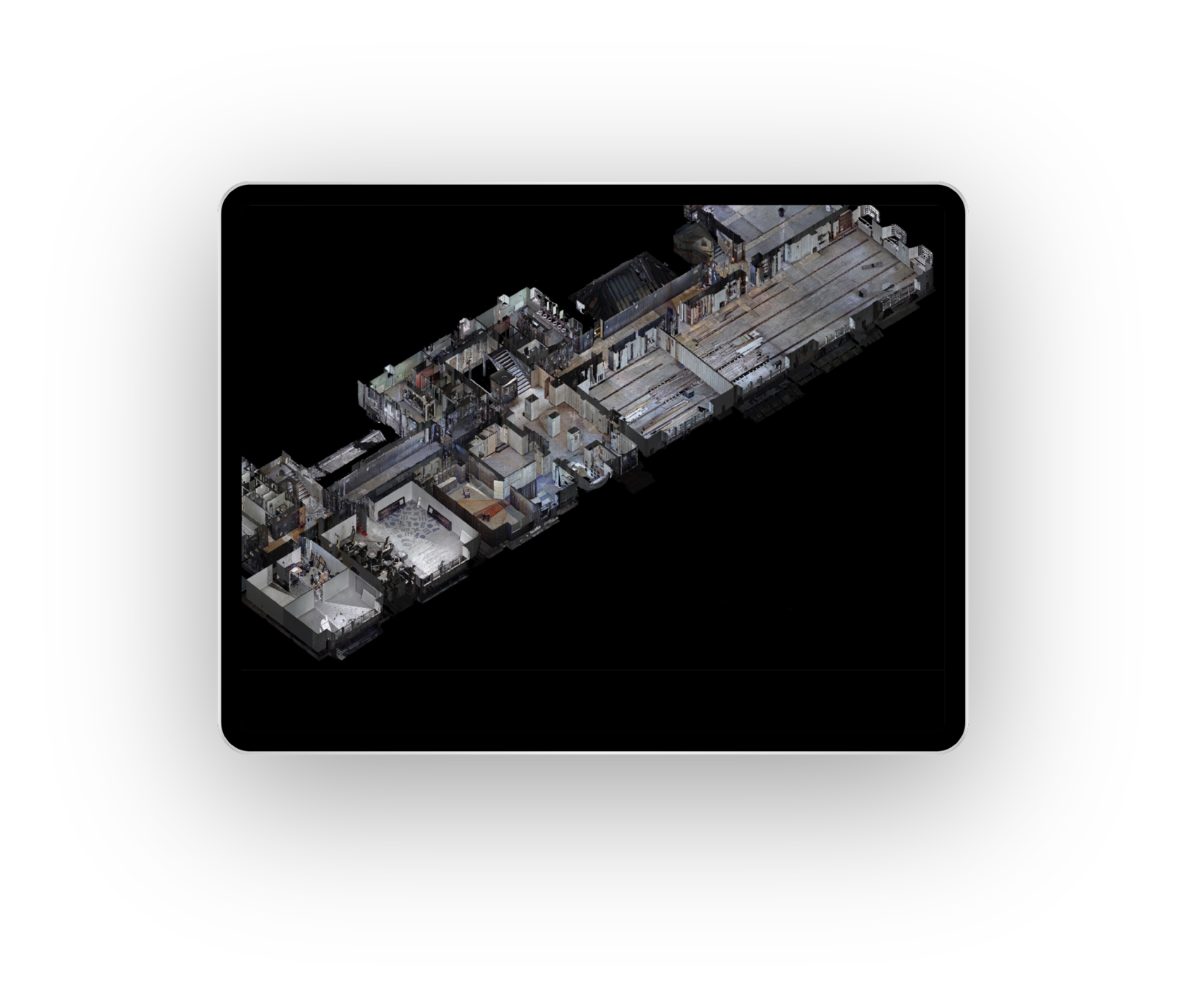
Object inspection.
Obtaining high-resolution data by conducting a flyby inspection using a UAV or scanning an object with capturing all the necessary zones, dimensions or heights.
Accurate. Fast. Safe.
Object flyby within specific marks and trajectories using a UAV to get complete geometric information about the object as a points cloud.
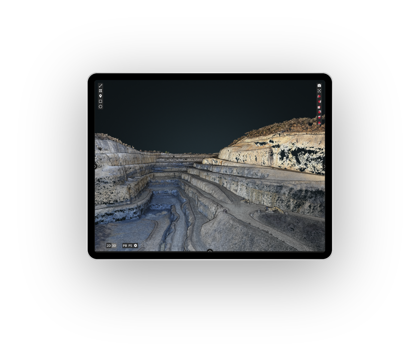
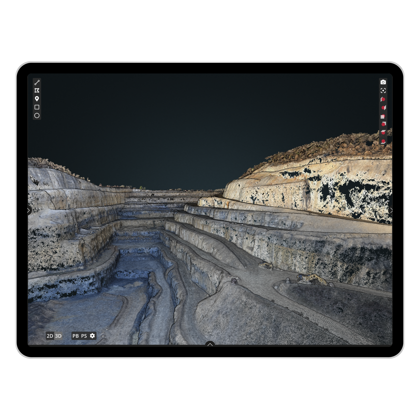
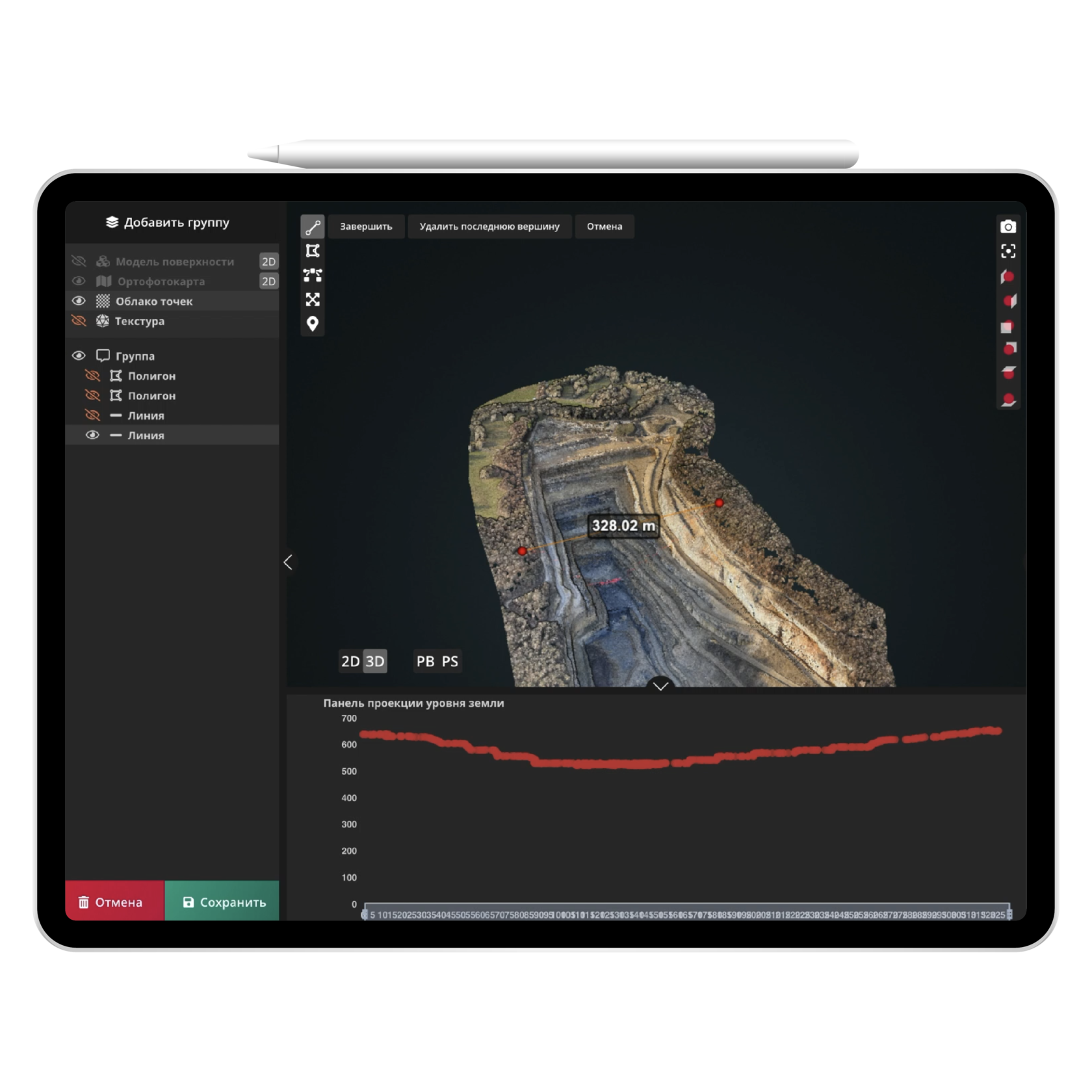
Accurate measurement of object metric parameters: volume, slope, distance.
Analysis of the relief and heat map option for heights and depths object identification. Personalizing 3D model via creating individual layers on an object with a set of required characteristics.
Analysis of the relief and heat map option for heights and depths object identification. Personalizing 3D model via creating individual layers on an object with a set of required characteristics.
Effective tool
For decision making
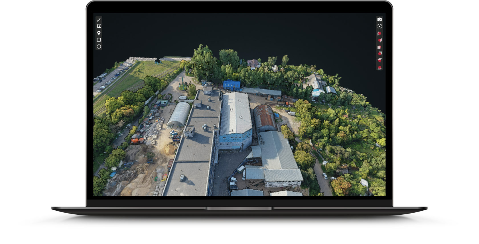
Visualization and viewing of the object in 2D and 3D models in high resolution with the option to overlay the object on the map of the area.
Automatically texture application to an object for a clearer and more realistic visualization.
Automatically texture application to an object for a clearer and more realistic visualization.
Accurate measurement of object metric parameters: volume, slope, distance.
Analysis of the relief and heat map option for heights and depths object identification. Personalizing 3D model via creating individual layers on an object with a set of required characteristics.
Analysis of the relief and heat map option for heights and depths object identification. Personalizing 3D model via creating individual layers on an object with a set of required characteristics.
View and compare object data in plans and reality during construction.
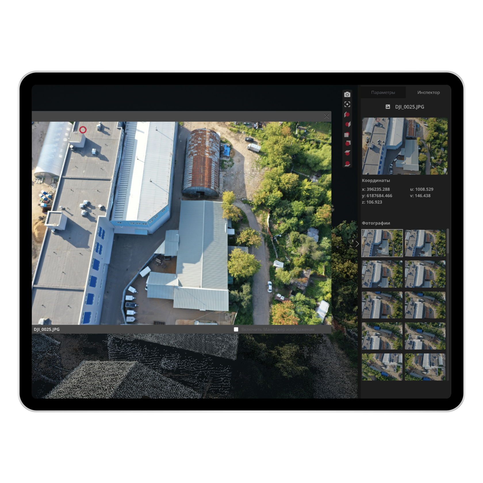
Investigate each point on an object in a 3D model in photos.
Marking problems and dangerous areas, checking and monitoring the status on-line.
Investigate each point on an object in a 3D model in photos.
Marking problems and dangerous areas, checking and monitoring the status on-line.
Integration
The platform is easily integrated with both internal systems of the company and external platforms and services, and does not require special technical skills and support.


Easy and affordable
Data analysis
and management service
and management service
Teamwork
Joint work on the project with the distribution of roles and granting access rights. Using the object layout when working with contractors.
Storage and access
Data can be stored both in the cloud and on the server. Ability to access the platform and make changes on any device.
View the demo version of the platform
Test yourself the functioning of our platform and assess its capabilities
Точное измерение метрических параметров объекта: объема, уклона, расстояния.
Анализ рельефной и тепловой карты высот и глубин объекта.
Создание индивидуальных слоев на объекте с набором необходимых характеристик.
Анализ рельефной и тепловой карты высот и глубин объекта.
Создание индивидуальных слоев на объекте с набором необходимых характеристик.

Our website uses cookies to distinguish you from other users of our site. This helps us to provide you with a good experience when you browse our site and also allows us to improve our site. By continuing to browse the site, you agree to our use of cookies.